I wake up with no recollection of where I am.
I look at the clock radio and finally realize I’m in a hotel. But where? The previous day’s drive seems like a dream in this groggy state. Motel 6 . . . Medford, Oregon . . . really?
I shower and am out-the-door by 9:30 am. The Passat Wagon is running on fumes, and it’s a little after 10 when I pull into the gas station. I try to pump my own but am rebuked (apparently there’s no self-serve in Oregon), and instead a middle-aged woman who looks like she could go a few rounds with Tyson does it for me. I pay her cash for the overpriced dead dinosaur fuel, and I’m heading north.
There’s a mass of giant cotton ball clouds filling the upper portion of my windshield, and they accentuate a big rock formation poking out from the top of the hill.
I’m listening to Allman Brothers now, and that’s great traveling music no matter where you are. I see a sign for “World Famous House of Mystery in the Oregon Vortex” and wonder if I should shudder. A sign for Scenic Byway 99 taunts me, and I wonder why I don’t take the exit?
Why the rush to Seattle?
I have two very good friends I’m going to see there, but what’s a few hours in the grand scheme of life? Nothing, but I still have that, I guess I’ll call it American, instinct to plod onwards for good or ill. So I look up at a cloud shaped like a wineskin (which makes me think of Hemingway and Spain and how I’d love to go there someday), and I can’t wait for the drinks I will have when I reach Seattle.
My car ascends into the mountains, and my attention shifts to my blunder of not getting any coffee this morning. Sure, I’ll be able to drive longer without using the restroom, but I’m sacrificing much needed caffeine. A cup of coffee right now would be magical.
Rouge River Route 99, the scenic byway, sneers at me as I pass it, calling out my stupidity for plowing onward. But the freeway here isn’t like it’s boring middle California counterpart, as there are green mountains to my left, green mountains to my right, and those wonderful marshmallow clouds in recumbent pose above.
But the Passat is really laboring with this hill, curving up to Sexton Mountain Pass, a 1,960-foot elevation with a very steep grade. I drive past all sorts of sights I’d like to see – beaches, caves, historic covered bridges. The 7 Feathers Hotel & Casino is another, where some hands of poker beckon to me again. And how can you shun a casino that is in a town called Riddle?
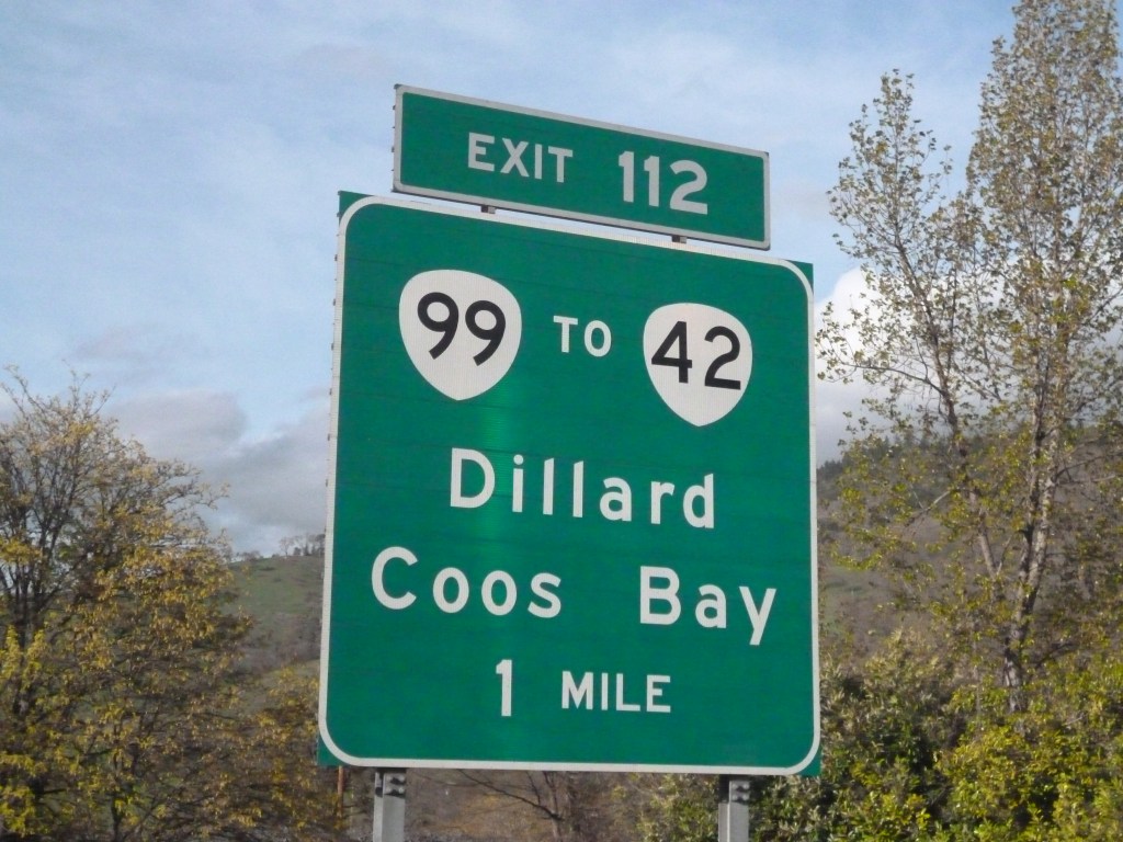
I look longingly at exit 112, which is Coos Bay (I think that’s where they filmed “Cuckoo’s Nest”, but I could be wrong). There’s free coffee advertised at that rest area, but I keep on going. What the hell is wrong with me? Would I stop for “Free Money, Strippers, and Beer”? I don’t answer that instead look at my odometer, which reads 118,268. As I head into Rice Valley there’s scattered rain that escalates into an all-out sun shower as I pass Elk Creek.
The new wipers, which I installed myself after an hour of struggling (anyone competent could have done it in five minutes) are working well. Just passed a guy with a backpack walking up the hill by Sage Brush Road, and another dude biking on the other side. Healthy hardcore bastards. This is definitely not scientific, but I think people drive safer in Oregon. A little more space between the cars. I’m heading into Eugene now and the sky has morphed into one solid gray and ominous cloud.
The land is flat, the grass is yellow, and the mountains loom in the distance. This is the flattest territory I’ve seen in Oregon, and for the record it’s a town called Brownsville. I just passed a rig hauling a bunch of crushed cars and a chill runs down my spine. I see myself stranded on the road and the Passat flat as a pancake after some horrible misfortune.
Luckily AC/DC’s “Big Balls” plays on the radio. That song is still funny after all these years and can erase bad thoughts. A guy with a California plate just cut me off and snuck around a truck. Albany is the next 2 exits.
There are a lot of familiar East Coast town names out here, and now Salem (eighteen miles away) and Portland (which is 64) to join the mix. I keep seeing all these signs for the coast, but you can’t spot any water from here. The curse of the 5 Freeway. But I’m somewhat consoled by seeing my first sign for Seattle. Although any excitement is hampered by reading the “224” next to it. And here comes the rain.
I pass exit 258 in a steady downpour with poor visibility, with the trucks making it worse by kicking up all the water. At Exit 260, Keizer, the rain lifts for a mile or so and then returns. I’m 40 miles to Portland, and the St. Paul Rodeo is being advertised for July 2,3,4th. I wonder if I’d like to see a rodeo, or if it’s something that sounds cool but would not actually interest me.
Torrential downpours as I get on the 205 heading toward Seattle. I had planned on stopping in Portland for lunch, but with the rain I changed my mind. The 205 Freeway is probably a quicker route, and it gets me off the god-awful 5 for awhile. But that still doesn’t solve my hunger problems. I would love an In & Out burger right now, but that’s California Dreamin’. It’s a steady diet of rain, rain, and more rain.
I eventually stop in some generic town for a generic cheeseburger from Wendy’s. Now I’m stuck in generic traffic as I try to get back on the freeway, and it seems worse than L.A. I guess when you eat fast food, you deserve this kind of treatment. I don’t even know where I am . . . somewhere on 82nd drive.
But I do make it back to the freeway, and although the rain has cleared, I’m greeted with a mass of construction and a lot of traffic. It eventually clears and a sign says “Oregon thanks you, please come back”. I cross a four-lane bridge over sparkling water with green land ahead, and just like that I enter Washington. Grand. Peaceful. And some bastard just threw out a plastic cup out of his window.
Tall fir trees to my right and left now, and the sky has cleared to show some shape-shifting clouds. The trees are much closer to the road than Oregon and California, and I keep going over these partially covered bridges, with the steel girders, which kind of reminds me of the one going to New Hampshire on the 95, or even The Tobin in Boston, but much smaller. Mt. St. Helens National Park is close by, another cool thing I’m not going to see. The trees have some red in them. Passing some sort of river or lake.
Washington drivers, from first impression, seem more aggressive, but not in that asshole California way. At the Port of Kalama I begin my first incline, but it’s not too steep. The Kalama River looks to be some sort of logging depot. It’s an industrial area, with a structure that almost looks like a small nuclear power plant. Even though I’m sure there’s no atom spitting going on, I bet there’s plenty of pollution.
And I’m now cutting through a rocky cliffside, with the trees hanging off the precipice, and there’s a net draped down off the rock. A sign declares “Christ Died to Save Sinners” and another states that there’s gas at exit 36. I enter Kelso and look at the big K painted into the grass on the side of a hill (ostensibly for Kelso), and that’s right next to the Motel 6 advertising $49 a night.
Who died to give motorists cheap lodging?

This is a hilly region, with many beautiful trees, some light green, some with a little yellow in them. Now that I’m getting closer to Seattle, only 123 miles away, the world seems to pass by slower and slower. You get that destination in mind, and you keep checking the odometer, and then anticipation makes it longer. Just like staring at water waiting for it to boil.
Mt. St. Helens is the next right, and I really like these bridges with the steel girders painted a light brown color. Another rest area with free coffee tempts me, but I keep onward. Mount Rainier and the Lewis and Clark State Park is the next right, but I keep on trucking forward. The Lucky Eagle Casino might be fun, but I keep driving. But I could really use some Tums after that awful cheeseburger.
I can see the state capitol building in Olympia, which is exit 105. There is blatant tailgating here, double lane switches and no directionals of any kind. California driving. In Oregon I don’t think I saw one person change lanes without signaling. And here comes the traffic. A sign just declared: “Heavy Congestion Ahead”. Lousy Tacoma. Is it because of that Tacoma Dome thing I see in the distance? Is it because of the Museum of Glass? Haven’t been fully stopped like this since Sacramento.
The traffic clears once I pass the dome. Is it because everybody wanted to drive on the Enchanted Parkway? Seattle is only 21 miles, and the odometer reads 118,602. Maybe it’s corny, but I put on a Pearl Jam tape to play me into Seattle.
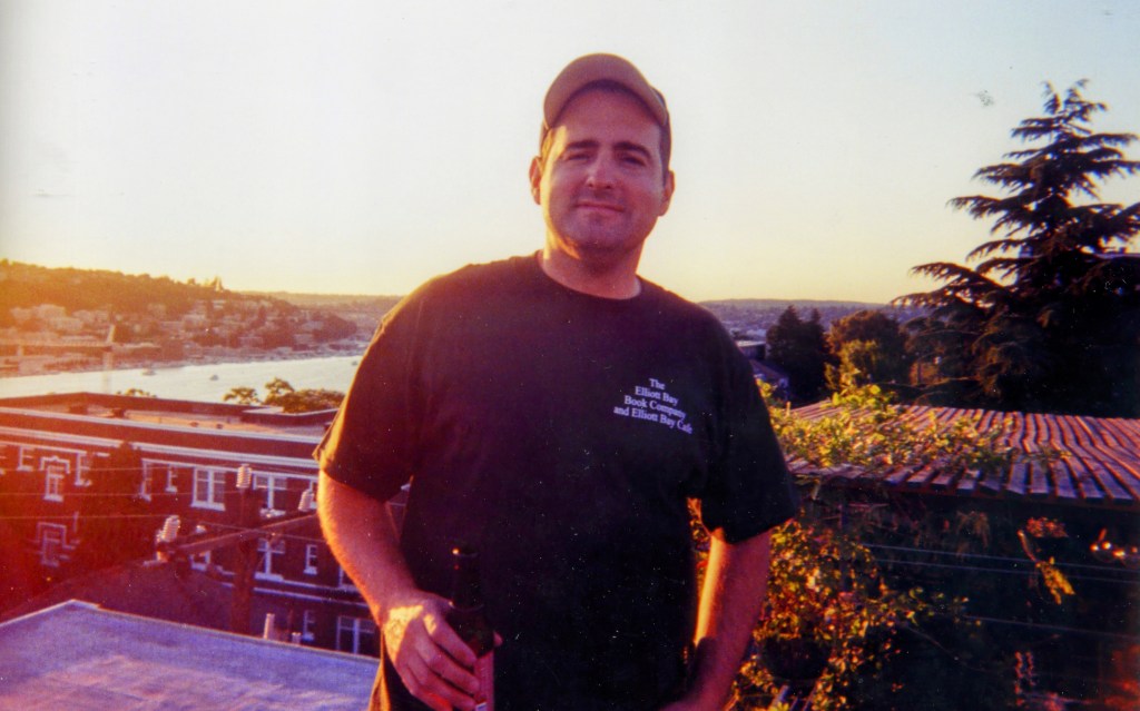
While I’ll eventually go to Seattle, the first stop is in Sammamish to visit one of my best friends. John and I went to high school together and our friendship has not waned since. Why do I suddenly remember a drive with him to Worcester, our senior year in high school, so John could visit WPI (Worcester Polytech), the college he would eventually attend. Back then a drive from Lynn to Worchester without your parents was far, and we listened to Led Zeppelin all the way there and talked about the meaning of their lyrics and about college and how exciting growing up seemed. It was a drive you’ll never forget.
They don’t give you much warning on that 405 North Exit, which I need to take to Sammamish. I quickly maneuver onto the 405 and into traffic, just like the 405 back home in California (un-affectionately called “the parking lot”). This is thick and juicy traffic, L.A. style. I’m getting close and my bladder is throbbing.
At all my other stops I was never at a critical mass to pee. This is next level. And now I get onto the 90 east, which brings me into Sammamish, with the lake on my left and some mountains in front of me. I’m thinking of peeing into a cup while I drive, but hold off.
Everything is very green and lush and fertile, dare I say fecund. Lake Sammamish State Park is a popular exit, with throngs of cars getting off there. It’s Exit 17, Front Street, and there’s a little bit of rain. I’m supposed to turn right at the gas station and go up a huge hill . . . but first I’ll stop, get gas, pee, and call John to let him and Beth (his wife)know that I’m close.
I’m glad I do this, because John gives me more detailed directions that, without, would have made the journey to his house nearly impossible. The planned community where he lives looks expensive . . . from the houses to the roads and just the overall vibe says “money”. My beat-up Passat Wagon says “pauper”, but who cares. I’m looking forward to seeing John, Beth, and their two kiddos.
After two days of driving north from LA, I’m going to enjoy spending time exploring Seattle.

How did I miss this one? Ah yes…. I know the drive you describe o’ so well. I only wish it were as quick as this post to get through. Portland, Tacoma, and even Salem somewhat can very well become LA traffic-ish (as can the 405, as you found, and the 5 through Seattle).
I too have really wanted to stop at the HOUSE OF MYSTERY and MOUNT ST HELENS among other spots on the drives north or south. Nice write up. I was totally there with you.
I’ll see if I missed any other entries.
Cheers
LikeLiked by 1 person
Thank you, Shawn!! I was actually going to ask you if you’d been to the House of Mystery. 😊
LikeLike
I have seen that several times coming and going. I always wanted to stop—but anyone with me at the time wasn’t interested and just wanted to push through. Waaaagh! Someday, perhaps… Cheers!
LikeLiked by 1 person
Yes, hopefully someday on your roadside attraction adventures!
LikeLike