It’s 11:30 am and I’m finally heading into Yellowstone National Park. I just paid my $20 entrance fee, got my map, and tall trees saturate the scenery to my right and left. Would have been nice to get an early start, but I just couldn’t get up.
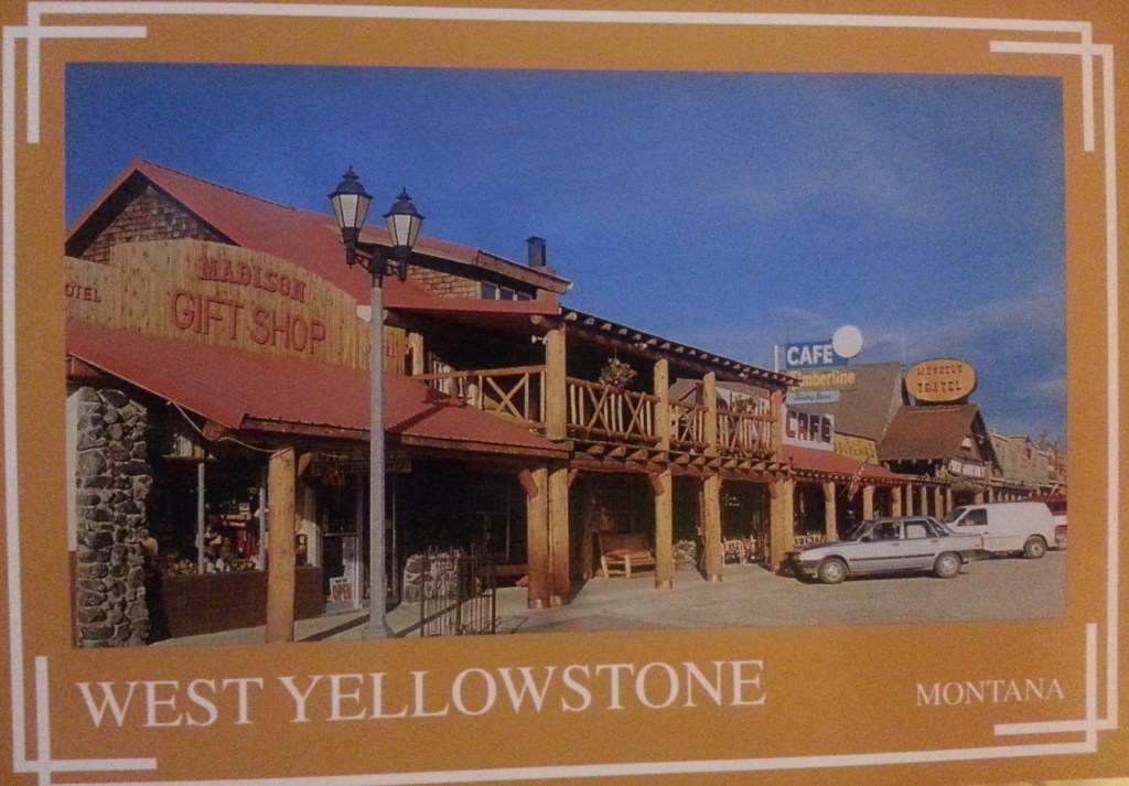
After arriving in West Yellowstone yesterday I took a two-hour nap, woke up very groggy, and then walked into town for dinner and drinks at a rustic tavern with wagon wheels and western bric-a-brac. I got a few more drinks at another bar and then was back in my room to write in my journal and watch TV. I was hoping for an early night, but my afternoon nap kept me up late.
I’ve done exactly zero research on this park. Unless you count looking at the placemat at the restaurant last night, a cartoonish map of Yellowstone complete with bears and buffalo. It was obviously not done to scale. Just a glance at my official map proves this place is fucking enormous.
For context, Old Faithful is 30 miles away . . . the equivalent of driving from my apartment in LA to Hermosa Beach where my friend Paul lives. I love hanging out with him and enjoy that area, but I rarely go because it’s too long a drive. And now, my first sight of many I’d like to see is that distance.
It’s going to be impossible to see everything I want, but what I can do is drive around the park and get a feel for it. I’ve entered Wyoming, which is, I think, the 40th state I’ve visited. Don’t know the speed limit here. Don’t necessarily care.
I’m passing all these burned trees and it makes my heart ache. I don’t know if they’re from the ’88 fire or something more recent. It’s an eerie sight! You enter the most famous National Park and the first thing you see are thousands of burned trees. Rows of charred sticks jutting up from the ground conjuring up the word barren.
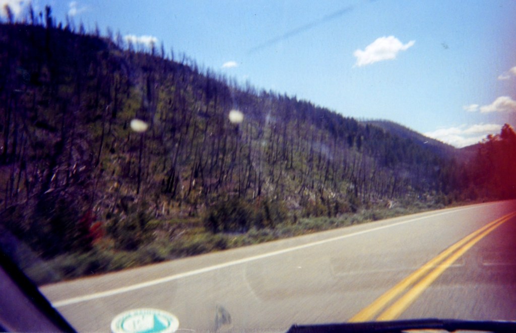
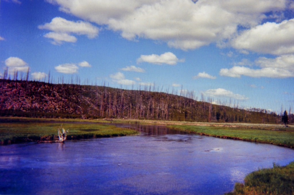
To my right there are healthy trees next to the river, but all the others are scorched. It doesn’t have the fresh, soot-like quality, so I imagine this is the damage from the fire 15 years ago.
I pull over at Madison River and watch a guy fly-fish, thinking of A River Runs Through It. This is a nesting habitat for the endangered Trumpeter Swans, but I don’t see any. For some reason I feel compelled to snap some pictures of the burned trees. On the news they report all those fires in California and Florida and there’s one in Arizona now; you see the flames but they never show you the aftermath. It’s simply spooky.
After looking over that map and being overwhelmed at all there is to experience in Yellowstone, I get back on the road. Sure, it would have been nice to get up early, but when the alarm went off at 8 am I still felt groggy and I couldn’t wake up. My mind is alert now, and that is more important that gaining a few hours.
I just passed Mt. Haynes Overlook, elevation 8,235 feet, on my right, a sumptuous rocky ridge. There’s a river on my right that looks so peaceful I just want to lie down next to it and contemplate the universe. A wildlife exhibit ahead and I can see something, a deer maybe. What I really want to see are the buffalo.
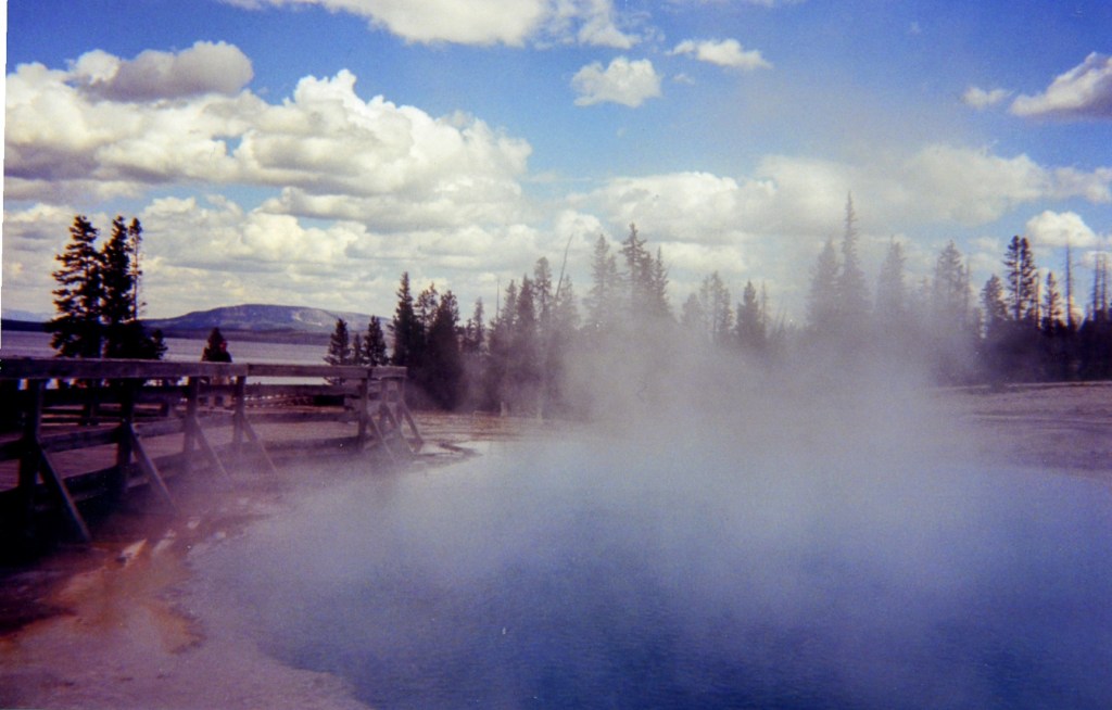
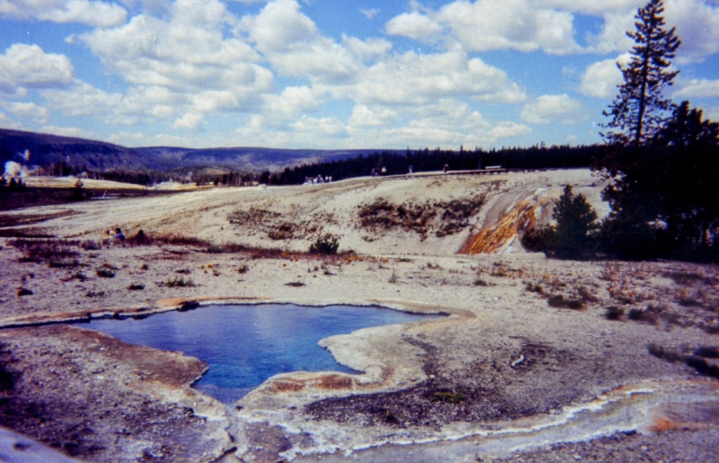
I reach Madison Junction, elevation 6,806 feet, and take a left for Old Faithful. Terrace Spring is on my left and I pull over and walk along a wood plank path. I spot my first geyser, bubbling up and creating steam over the water for a natural hot tub. It’s small, but I figure it will make me appreciate Old Faithful more. There’s a sign that says it’s unlawful to bathe or leave the walkway path.
I’m now heading south toward Old Faithful, and I after stopping there I plan to keep south, then go east, and loop up to the north. The road is curvy and in poor condition as I make my past a little gorge with fast moving rapids. The concrete smooths out, and now a lot of cars pass me in the other direction.
I’ve come to more roadwork and another stretch of only one lane. It’s a 12 minute wait (I’m the first car in the line and a woman tells me that), and I decide to use the time to read up on the places to see. Finally a pilot car (a pick-up truck with an orange sign on it’s back with black lettering) gets in gear, and I’m told to follow. I do, and enjoy the slow pace as we travel past Beryl Springs, which smells of sulfur, and all the cars stopped on the other side.
While waiting I learned that Old Faithful erupts every 40 to 126 minutes . . . which isn’t as faithful as I imagined. Two hours would be a huge buzzkill, but I have to see it.
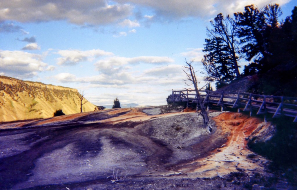
Just saw a sign for Norris Geysers . . . did I screw up? This is a Hazardous Thermal Area, and a stinky one, with Mammoth 22 miles down this road. It’s as if some prehistoric creature arose from the mountains and ripped a big fart. It’s a Hazardous Thermal Area. I don’t know if I’m going the wrong way, but I’m going to see these geysers, regardless of the stench.
After a quick tour of the bubbling beauties of Norris, I ascertain that I’ve gone the wrong way to Old Faithful. So now I must drive 14 miles in the other direction and re-cross all that roadwork. Stupid, but there’s no sense of beating myself up about it. Better to enjoy Elk Park, but I don’t see any elk from inside my car . . . wait, actually I do see one, two, three, four elk. That mistake just cost me somewhere in the neighborhood of an hour, but I did get to see some cool stuff.
The windshield is full of blue sky and big puffy clouds as the road curves up past the trees. The river is close to the road here, and I get a good look at the man fishing. His face radiates happiness and contentment, and I’d like to be there with him.
I’m only getting a little taste of nature; this is seeing, but not experiencing. Fishing would be experiencing, and so would hiking or camping overnight. But just seeing all of this up close from my car is amazing, and honestly, I feel very grateful just to be here.
I reach the Chief Joseph Site and pull over. The sign reads: “The Nez Perce campaign of 1877. During their fighting retreat toward freedom in Canada, the non-treaty Nez Perce passed right through Yellowstone Park in Aug. of 1877. They came upon this creek when outriders caught a party of sightseers camping near-by. The Nez Perce held them for hostage for several hours. Angry at past betrayals, a pair of Nez Perce shot and left for dead George Cowan. But a chief intervened, and the rest of the tourists were released unharmed. 6 weeks later the Nez Perce surrendered to the U.S. army in northern Montana. They were then transferred to reservations far from their homeland.”
I walk down to the creek, with its purple flowers, fallen trees, and lone fly fisherman. None of this stuff was taught in history class when I was growing up. I remember learning about that incident on the PBS documentary The West (which I originally saw in ’96 and watched again a year ago). So shameful what the people of this country did to the Nez Perce and all the tribes back then. It’s sickening.
Back on the road and there’s a beautiful expanse of meadows, with Mary Mountain presiding over it. There are some springs bubbling up with steam on my right, with the obligatory sulfur smell, and I pass my third biker. That water is intensely blue in some spots.
It’s about 2 p.m. and I drive by Whiskey Flats and dead trees clinging to the side of the mountains. It’s so peaceful here. Right up until a Porche nearly rams into the back of my car, tailgates, and passes me.
That douchebag is the only asshole driver I’ve encountered in Yellowstone. It was my first temptation to give the finger on this whole trip, but I didn’t. This is a spiritual journey, one to soothe my nerves, brain, and soul . . . not one to cultivate anger. But if I see his car at Old Faithful, it will take a lot of inner strength not to key it.
Old Faithful is one one mile away with the elevation is 7,341 feet, and there’s a little creek with steam emerging off it. The Old Faithful Inn is on my left, with a gas station and a general store. There are a lot of cars exiting, and I probably just missed the eruption. I stop in the store for my lunch.
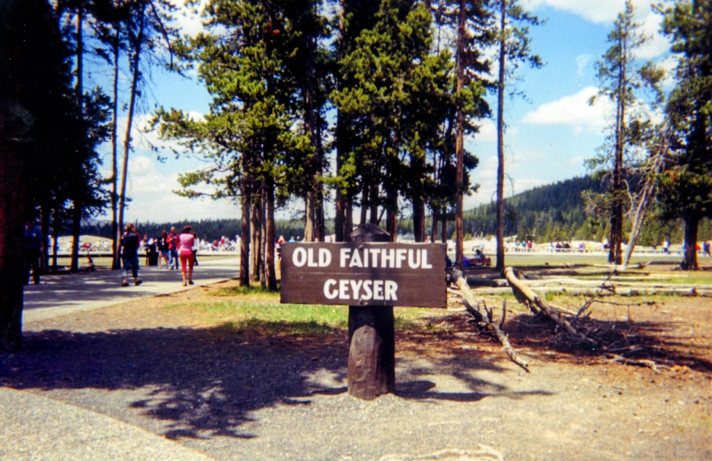
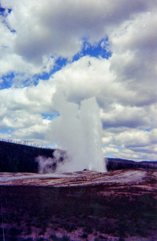
Back in the car now after seeing Old Faithful, an iconic sight that lived up to its billing. Thankfully I only had to wait about 40 minutes. I ate a ham sandwich, macaroni salad, and plums bought at the general store, and then walked around that wooden deck area and got to witness Old Faithful erupt and show off it’s beauty. Surprisingly I didn’t smell any sulfur, and you’re probably about 75 yards from the center.
At 3:30 pm I’m now heading toward West Thumb, which is about 17 miles away. The road climbs and there are tall trees on my right and left, all healthy looking, with big puffy clouds and blue sky above. After several curvy ups and downs my car struggles to navigate, I pass the Continental Divide. Damn, how cool is it to pass the Continental Divide. I think of the John Belushi film I’ve never seen.
A motor home drives in front of me, struggling just like my Passat. I wonder when all these roads were made. Yellowstone was established in 1872 as the world’s 1st National Park, but the pavement is of course relatively recent. Yellowstone Lake sparkles on my left as I drop straight down with some snow-capped mountains to provide even more beauty. I’m going to park at West Thumb.
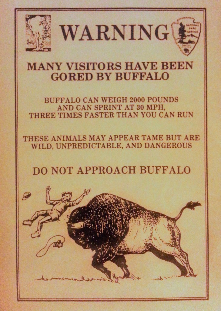
Out of the car now, I see my first “Caution Buffalo” sign and my heart quickens thinking about glimpsing one of those animals. I’ve seen them on TV and from the freeway 12 years ago in Colorado, but never up close. There’s a path that loops around geysers and hot springs and it leads down to the placid Yellowstone Lake, a pure joy to look at. The water grabs your attention, the steam brings mystery, but where are the buffalo? I loop around the path and head back to my car disappointed.
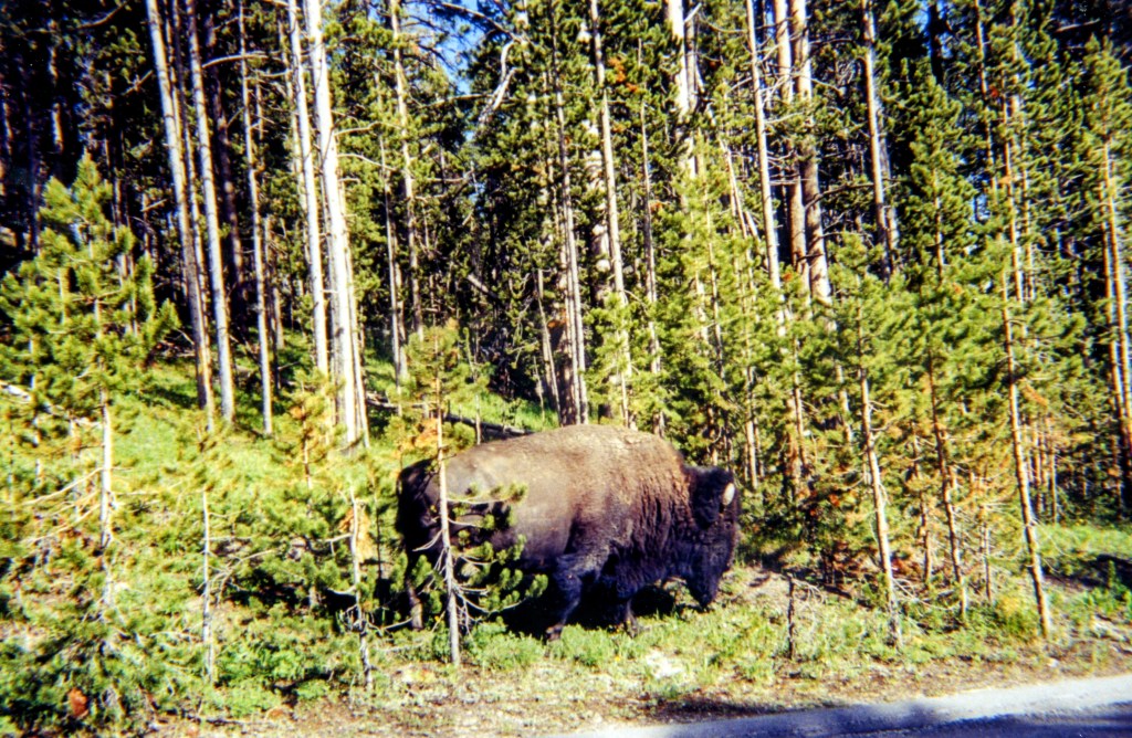
But wait . . . what are those people looking at in that field? It’s a massive buffalo, and it can’t be any more than 25 yards away. I stand there transfixed, smiling in awe. I don’t want to leave, but there’s so much more to see here. Goodbye, Mr. Buffalo.
Back on the road and this is wonderful driving. In my rearview are snow covered mountains over a lake, and tall trees flank my car on either side. I need to come back and spend a few weeks kayaking, camping, hiking, and fishing in this slice of blissful wilderness.
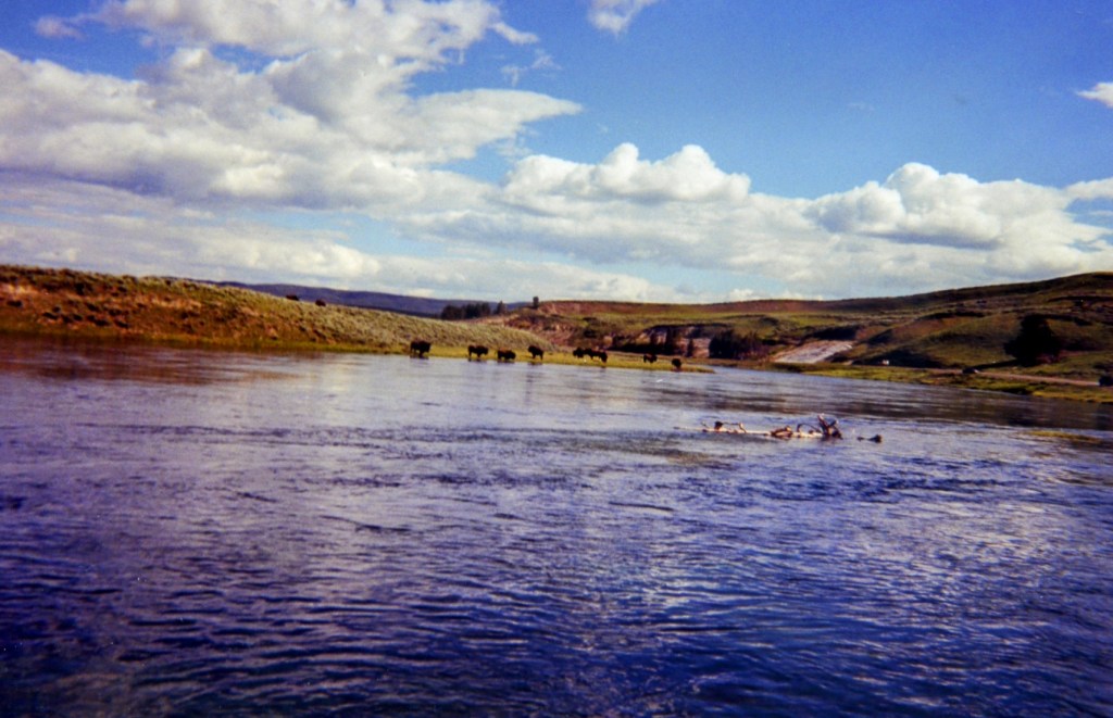
I’m 17 miles to the canyon, and I slow down to see two more buffalo near the road. Another beautiful river, surrounded by green grass and with tall trees behind, snakes with the road. It is all stunning, so unlike anything I’ve ever experienced. A sign informs that Sulfur Cauldron is ahead, but I can smell it before I can see it.
It’s intensely green out here. Little creeks and ponds dot the topography, and lush trees loom beyond the valley. Swirling snow trails, looking like a Matisse brush strokes, decorate the mountains in the distance. And if that wasn’t enough, I’m counting ten buffalo down by the water.
I pull over for a picture, but my attention is drawn twenty feet to my right. There’s a buffalo there! I have to do it, I have to get as close as possible.
I walk slow, slow, slowly and get to about ten feet away and just stare at that enormous creature. Fucking incredible. I hope it doesn’t charge, and I’m not the guy on the warning sign getting thrown up in the air. I snap a picture and inch my way back to my car. If the buffalo noticed me, it sure has a good poker face.
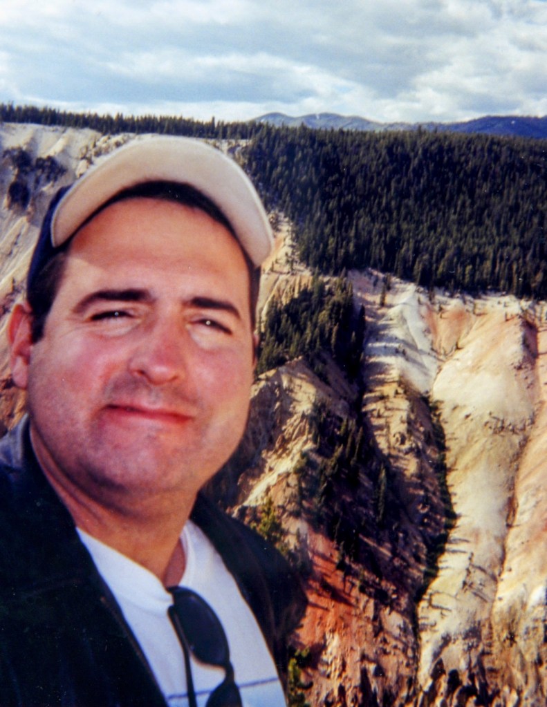
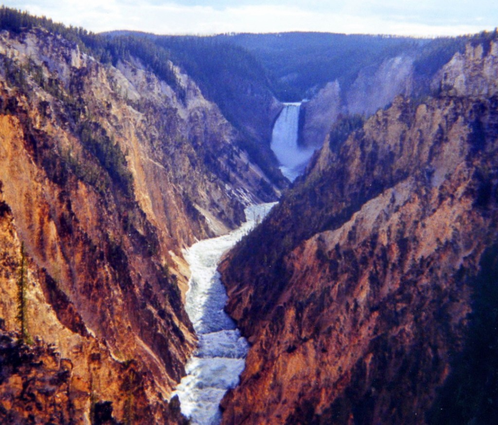
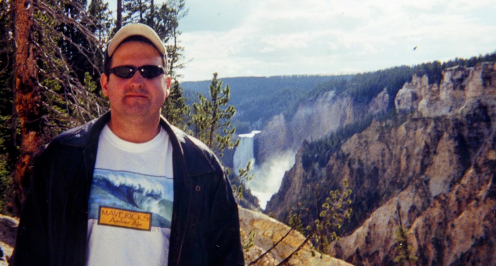
It’s still lush, green, and vivid pastureland all around, with a scattering of potholes on this road. There’s a sign for Artist’s Point, and although I’m not sure what’s there, I park and get out of the car to walk around. There is a giant waterfall, a gorge, and hiking trails.
After taking some more pictures, I get on the Ribbon Lake Trail and make my way to Point Sublime. I obviously don’t have much time to explore, but I like the sound of Point Sublime and it’s only one mile away. I can’t go to Yellowstone and not at least do a mini hike.
Thus far I haven’t seen anybody else on the trail, and it’s quiet except for the wind and the rustling trees. The path snakes around the canyon, where river rapids cut through the gorge below. On the other side of the rim a large contingent of people crowd around an overlook, and I revel in the fact that I’m here all by myself.
The trail goes up and down and up again, though it’s easy walking, and as I come to Point Sublime I read it’s closed due to hazardous obstacles. I feel a little like Clark Griswold getting to Wally World. If I wasn’t by myself and if I were in better shape, I would risk the hazardous obstacles. Instead I walk down another trail to a pond, which isn’t so sublime, but I’m not going to complain. I think it’s about 6 o’clock, and I finally see my first human on this trail as I reach the end.
Back in the car now and it’s time to get moving. It’s 6:45 pm . . . yikes! I think I’ll go to the Roosevelt Tower, hit Mammoth Hot Springs, and then I’m done. Afterwards I’ll get as close as possible to Mount Rushmore and find a cheap hotel. I probably have about two more hours of sun.
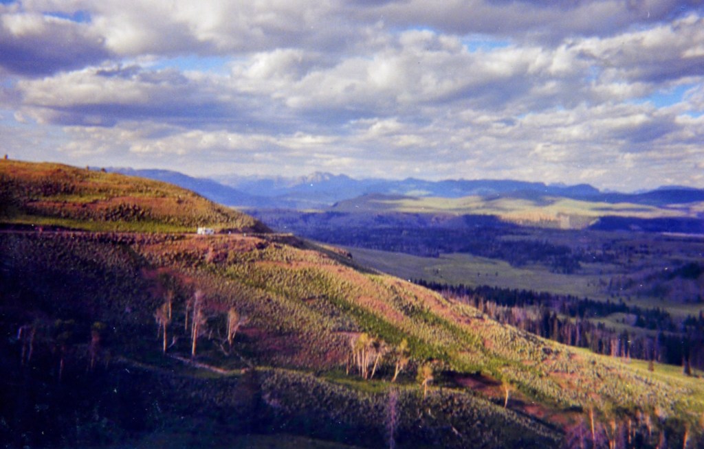
The trees to my right and left are practically on top of the road, and there doesn’t seem to be anybody else here. The Passat hugs the side of a ridge, with no barriers, and a cliff drops straight down on my right. This is heart of the Caldera and I pull over to witness this beauty, which is miles and miles of trees in front of me with snow covered mountains over by the lake in the distance.
It’s almost July and there’s big chunks of dirty snow on my left! The green hills are flecked with ice. This is Mount Washburn and Dunraven Pass, nearly nine-thousand feet above sea level. That explains the snow on the ground.
I go downhill on a 6% grade for the next 12 miles, with more snow on my right clinging to the road. This is a bumpy road, probably ruined by all the chains the cars use in the winter. On the other side of the canyon streaks of snow look like ski trails that lead to nowhere.
There is a big grassy area, right in the middle of a field of dead trees. This is a green that you will never see in a city or suburb or even the movies.
My ears pop as I come up on a little general store at Tower Fall. Steep ridge on my left, which is serrated and and a sign warns of falling rocks. At the bottom are some enormous boulders and a cascade of water rushing down that creek. I pull over and take a picture of the big precipice, the Calcite Springs Overlook. But without a good camera, those things don’t photograph well. I’ll find out whenever I can develop my film rolls.
Going down again and a series of potholes almost run me off the road. Nobody has passed me in either direction for dozens of miles. I’ve reached Tower Junction, with its horse corral and Roosevelt Lodge.
The sun has gone behind a very large cloud, giving my eyes a reprieve, and there’s puffy clouds all around on my left with blue sky on my right. But the sun returns quickly and zaps my corneas as I try to navigate this curvy road with hardly any room between the bumpy pavement and the hillside on my right.
The road finally becomes smooth, and I’m heading down this curvy path with beautiful scenery all around. The sun is again directly in my eyes, but I’m able to glimpse the rocky ridge of Wraith Falls. The Gardner River meanders below, and this is probably the longest bridge I’ve been over in Yellowstone.
I’ve finally made it to Mammoth Hot Springs, elevation 6,239, and there’s a place for me to park. Feels good to be out on my feet again, and I read a sign that says to allow two hours to explore Mammoth Hot Springs. I’ve got maybe 20 minutes. I make my way up the hill and stick my hand in the water that trickles down the rocks, and it’s hot as advertised. The path shows me many interesting rocks and springs, and my favorite is Reservoir Springs, with water dribbling down the rust-colored side. I buy some postcards and a coffee mug and it’s time to go.
It’s 9:15 and I’m heading out of town north on the 89, with my sights set on Highway 90. As a farewell gesture I’m treated to the Gardner River rushing down a gorge, with the mountains on top of me, and a curvy road. The sun is about to set and the sky showcases several shades of pink. I re-enter Montana at the 45 parallel, halfway between the equator and the north pole.
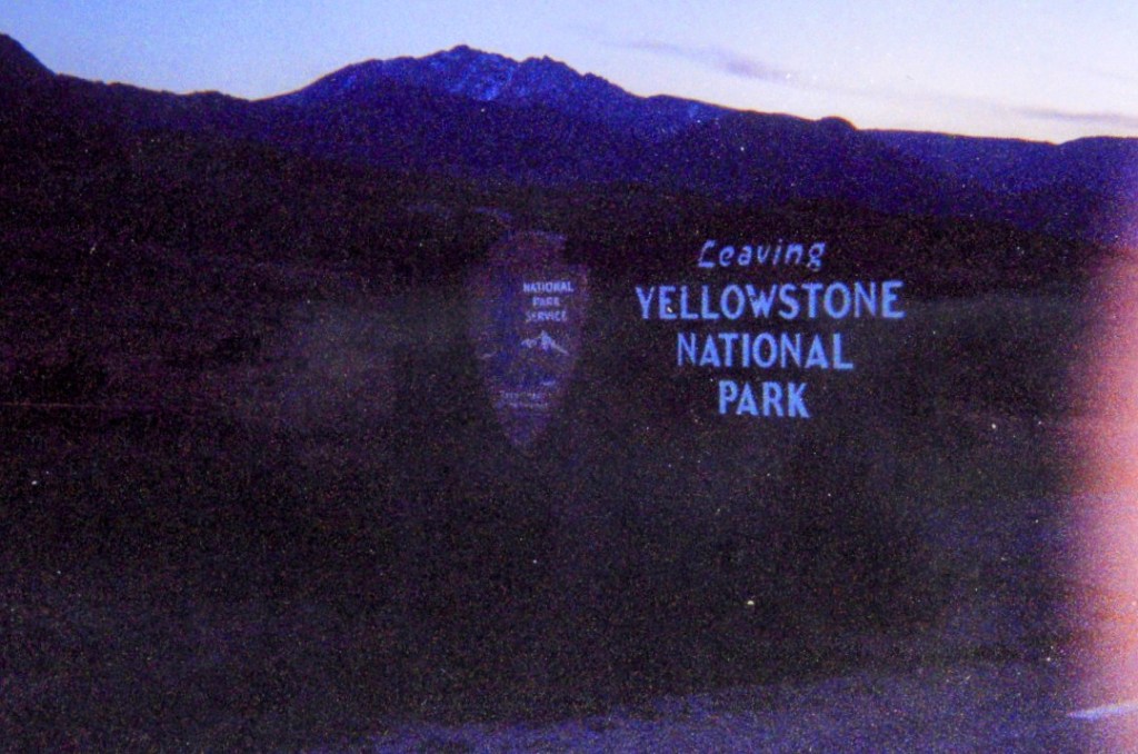
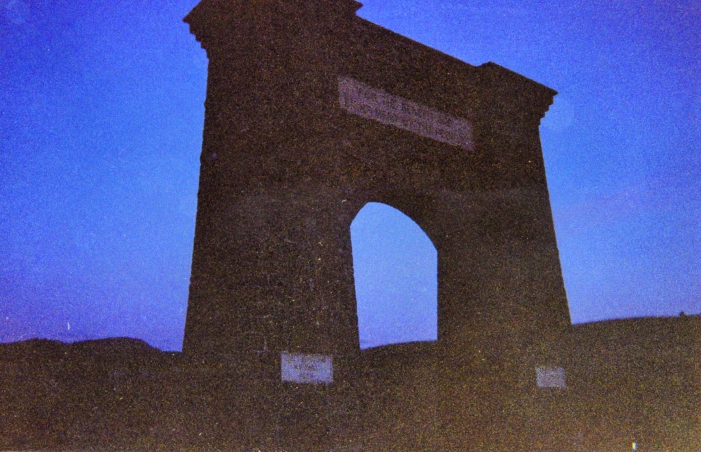
The sky is now a purple, red and pink ice cream swirl of clouds, and I pull over to take a picture. The elevation is 5,314 and I leave Yellowstone through the North Gate, the Roosevelt one, which turns 100 years old this year. I’m heading north towards Livingston, where I can resume my eastbound journey across America.
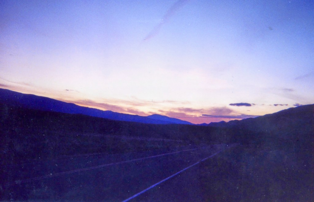
Dusk is my favorite time of the day, and this one is a spectacular. It’s a gray and purple sky, with the mountains becoming silhouetted. I’m Entering Gallatin National Forest, and a big Buffalo hump of a mountain looks like another world just sitting under that magical, never-ending sky.
It’s getting darker, but it’s still spectacular as I drive down, down, down into Yankee Jim Canyon. I have no radio, but I begin to belt out “Livingston Saturday Night”, and that town that only existed in a Jimmy Buffett song for so many years is now only 36 miles away. After a long flat stretch, it’s time to careen down a hill.
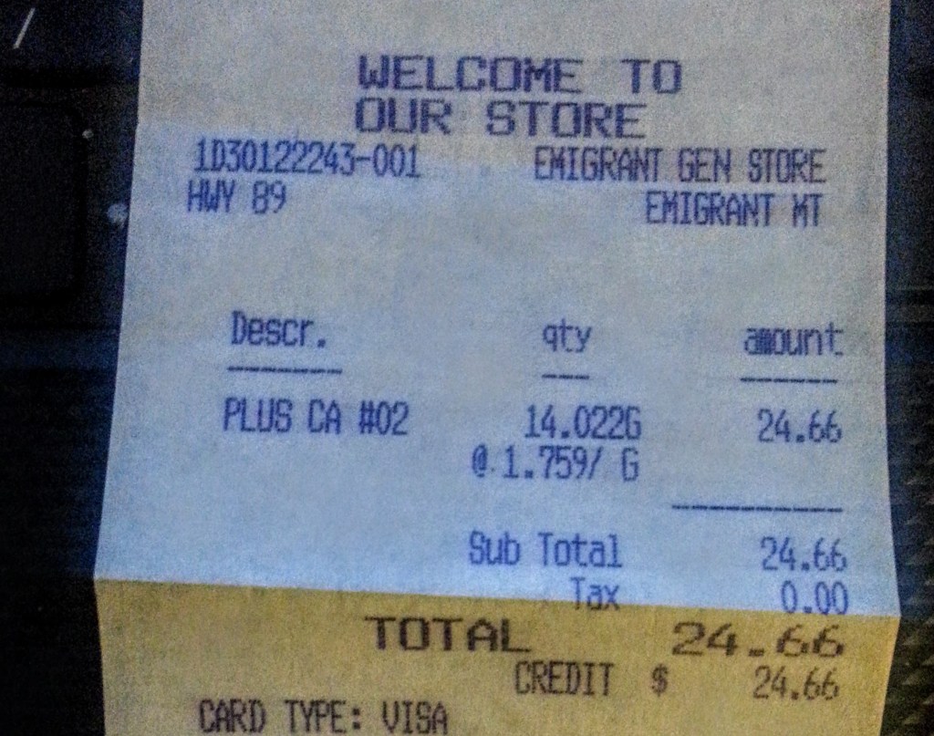
I need gas, and I stop in a town called Emigrant just after 10 pm. The Old Saloon, established in 1902, looks like a great place for a beer and some food, but I just fill up my tank and get back to the road. It is Dark out with a capital D, and when someone leaves their high-beams on it looks like one gigantic monster of a light that obliterates your vision.
The sun has set, and the blue-gray clouds spew out from the horizon and merge into that gigantic Montana sky. Not many cars on this road, which has been flat and straight since I left Emigrant. A cloud formation looks like a giant M now, and that makes me laugh.
Livingston, my God it’s finally Livingston, and I see a Steakhouse and Saloon. There’s a lot of hotels here, and it would be cool to spend a night in the town featured in the 1975 film “Rancho Deluxe”, but I must get further east. It’s 114 miles to Billings, and that might be possible, except it’s just darkness here. This darkness is a void, as a city boy it’s something I’ve never experienced before.
The Speed Limit is 75, but I don’t feel safe going faster than 60. Big Timber is only 27 miles away, and I might have to come up lame there. The wind blows the car around, making me even more jumpy. I do not like driving when it normal dark, and in this vacuum of space it’s intolerable. A truck passes me, and it’s lights give me some assistance in following the road. It’s now 11 p.m. and the road is ascending again.
A sign says that the Crazy Mountains are on my right, made famous to me from another Buffett song, but I can’t see them. I spot a Super 8 Motel at exit 367, and it’s time to get off this sinister road. Thankfully there’s a room for $50. Although I will climb into bed after taking a shower, it will be after 3 a.m. that I finally fall asleep. The sights, sounds, and smells of Yellowstone keep my mind buzzing.

Hooray! Another part of your adventure. I’ve had several false starts to Yellowstone–but have yet to make it there. I’ll just have to GO some day. I really want to. Your visit reminds me of some of my solo trips–like the first time I went to Europe (alone) and I only had an HOUR in the Louvre before it closed. It was a non-stop walk, walk, walk (with only a few minor pauses at thew Mona Lisa, Venus de Milo, and other notable artworks on the way). I saw it all–in the blink of an eye. But, as you probably realize now, looking back–however brief your time there, you maximized it and saw a lot. Good for you. Looking forward to the next chapter. CHEERS!
LikeLiked by 1 person
You will love it when you finally get there! A truly special place. An hour for the Louvre… yikes! My first time there in 1997 I was there for only 3 hours and I thought that was way too quick. But like you said, wherever you are, you have to maximize the best with the time you have!
LikeLike